


Spatial Scanning
DH_A specializes in sculpting figures of architectural space, shaped to respond to the moving point of view. A unique domain in which deploy this experiential approach is the design of living spaces constructed within multi-level penthouse properties at the summit of converted pre-war skyscrapers in New York City. These unconventional properties often have complex irregular spatial volumes and unusual structural systems that defy easy visualization. In working with our clients to realize the full potential of this spatially dramatic residences , DH_A is expanding our use of emerging technologies to accurately map, model and design hese complex site conditions.
Mapping the Summit of a New York Landmark
A paradigm of this complex spatial condition is the Pinnacle Penthouse, located at the summit of the Landmarked 1913 Woolworth Building in Lower Manhattan. DH_A invited industry leader Existing Conditions , a GPRS company and the national leader in 3D laser scanning and existing conditions surveys, to prepare a digital scan of the raw, tapering, six-story structural shell of the Pinnacle Penthouse, situated sixty stories above Broadway in Lower Manhattan.
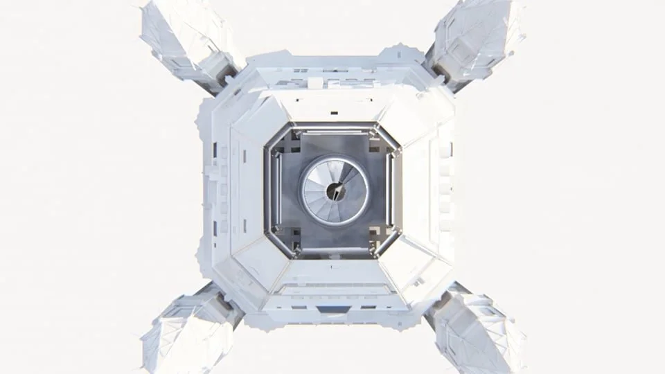
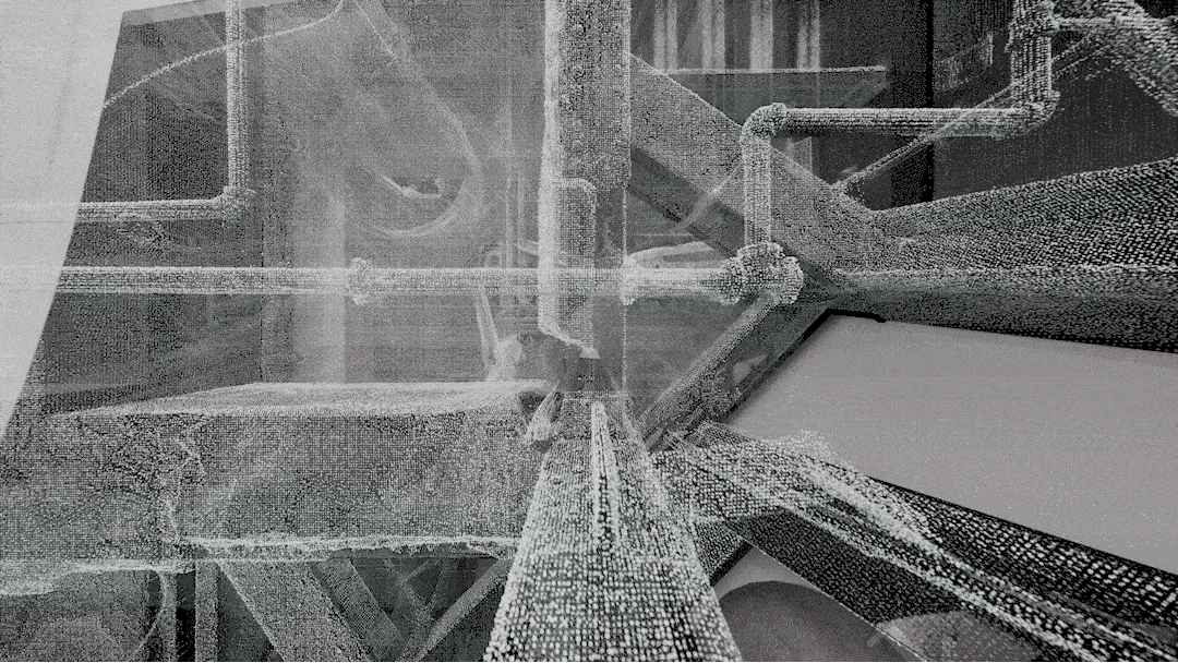
Mapping the Interior: A Terrestrial LiDAR Point Cloud Scan
To scan the complex tapering interior Existing Conditions used tripod-mounted Light Detection and Ranging (LiDAR) equipment, which tags the precise location of millions of individual points in space. The result is a point cloud, a diaphanous spatial model that renders every detail of the complex tapering interior as a matrix of points in space.
Existing Conditions then converted the point cloud data into a manipulable computer model, produced more rapidly, cost-effectively, and at a vastly higher level of precision than could be accomplished with a manual survey. Nesting the point cloud model inside the completed Revit model allows the design team to toggle between precise existing field conditions and proposed design conditions as the design process proceeds.
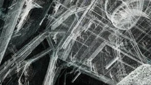
Mapping the Exterior: Drone-deployed Photogrammetry
After Existing Conditions obtained clearance from the NYPD, their FAA-licensed drone pilots scanned the intricate gothic-revivial exterior of the penthouse using aerial drones. Commercial drones cannot yet provide the stability and precision required for precise LiDAR point cloud scanning. Instead, Existing Conditions provided hundreds of photographs that document the otherwise inaccessible exterior of the penthouse from every point of view. These photographs were then stitched together in software that calculates the parallax between these separate views to create a rough three-dimensional model.
Modeling Lost Historic Details:
DH_A supplemented the point cloud and photogrammetry data by manually modeling details taken from historic photographs to re-create features of the original building that were lost during previous renovations.
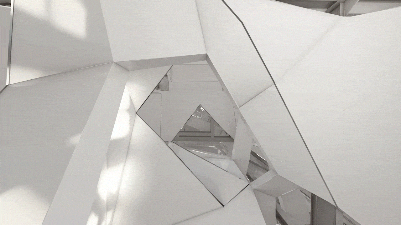
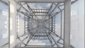
The Point Cloud as an expressive document
The diaphanous point cloud, with the series of digital models nested within it, is an architectural document with its own artistic qualities. Follow this link for additional explorations of the point cloud at the summit of the Woolworth Building.
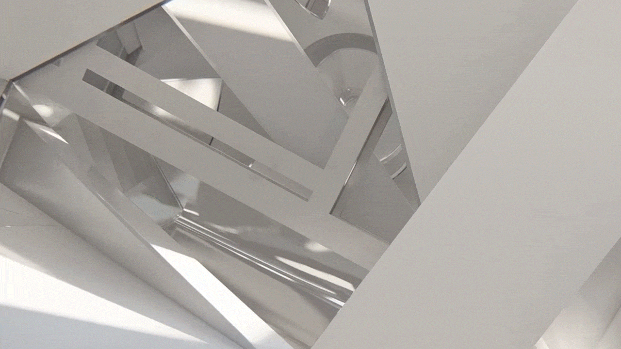
Enhancing Artistic Control of Challenging Spaces
DH_A creates precisely delineated figures of architectural space, shaped to immerse the visitor in a narrative of discovery. As demonstrated in our award-winning SkyHouse penthouse, constructed within the tapering summit of an 1894 skyscraper across City Hall Park from the Woolworth, a converted pre-war commercial skyscraper provides an extraordinary canvas for this enveloping experiential approach to the design of architectural space. The unconventional spatial volumes and complex structural connections at the apex of these early skyscrapers defy easy visualization. DH_A is expanding our use of three-dimensional scanning technologies to enhance artistic control of the enveloping medium of architectural space.